Monday 30 November 2009

Mapping future water stress

HOW WATER AVAILABILITY MAY CHANGE, AS TEMPERATURES, POPULATION AND INDUSTRIALISATION INCREASE

These projections of per-capita water availability were made by Martina Floerke and colleagues at the University of Kassel in Germany.


Waterdrop recorded at 2000 fps

This is a video i came across the other day. The amount of visuals that can be missed due to the lack of processing speed with our eyes is unbelievable, the sheer detail and beauty of the movement alone acompanied into an easily visible maintained speed is extremely visually pleasing, I could watch videos like this all day

Looking into the Oceans, BBC's Britain from Above


The technology of satellite radar has revealed the climate of the oceans. This enables vast weather systems to be detected, mapped, monitored and forecasted. This also shows how seas are expanding because of the melting of the ice caps as well as lakes drying up and causing water shortages.

Ships crossing the channel, BBC's Britain from Above


This visualization shows 24 hours worth of shipping, using ships GPS, as they pass through the Channel being dodged by ferries connecting England and France.
http://www.bbc.co.uk/learningzone/clips/world-water-supply/540.html

i-show you this vid

  • Title: World water supply
  • Duration: 01:26
  • Description: This clip describes how despite 97.5% of the world being covered in water, under 1% of it is availble to drink. It concludes by explaining how some Gulf states are using desalination as a solution to their water supply problems. With thanks to: NASA.
  • Subject: Geography   Topic: Rivers and Water Management
  • Keywords: gulfUKIndiawatersupplysea,desalinationresource management

Pipes from Below, BBC's Britain from Above


This is a short piece just describing and informing us about the sewage systems we have in place in the UK and how we deal with the waste we produce.

Water War, BBC's Britain from Above


This is a short piece showing how the same satellite technology that has revealed water reserves beneath the Sahara desert has now been applied to wartorn Darfur. This reveals that there is a lake half the size of Wales under wartorn Darfur.

Ste's Weather updates

"it looks like rain, but currently it is chilly, yet crisp" Steven Swanbaruga 13:25 30/11/09

The impact of coastal floods on Canvey Island, BBC's Britain from Above


This piece is about the residents of Canvey Island in the Thames Estuary that were badly affected by coastal flooding in 19. A range of archive materials illustrate the scale of coastal floods and their impact on the surrounding area. There is an interview with a former resident who was directly affected by the events, describing how people responded. To finish there is a section on flood defenses and how they are having to be changed over time.

UK weather patterns, BBC's Britain from Above


This is a short video extract taken from Britain From Above which explains how we get our weather reports and how the weather in the UK is effected by weather systems all over the globe. The last section of the piece explores the way in which humans are contributing to the risk of floods.

India

These are a couple more photos that I took on the trip. I picked these photos out because they both show the water in terms of society in different ways.

In this photos you can see the way that the women are carrying water on their heads. Here the ladies will be carrying water from where they found it back to their communities:


And in this photo you can see a man wading out to the large shipping vessels in order to get to work:

The gateway to India

When I went to India a few years ago we stayed across the road from the 'Gateway to India'.

The gateway is: "Mumbai's most famous monument, this is the starting point for most tourists who want to explore the city. It was built as a triumphal arch to commemorate the visit of King George V and Queen Mary, complete with four turrets and intricate latticework carved into the yellow basalt stone. Ironically, when the Raj ended in 1947, this colonial symbol also became a sort of epitaph: the last of the British ships that set sail for England left from the Gateway. Today this symbol of colonialism has got Indianised, drawing droves of local tourists and citizens. Behind the arch, there are steps leading down to the water. Here, you can get onto one of the bobbing little motor launches, for a short cruise through Mumbai's splendid natural harbour". (http://www.mumbainet.com/travel/gateway.htm)

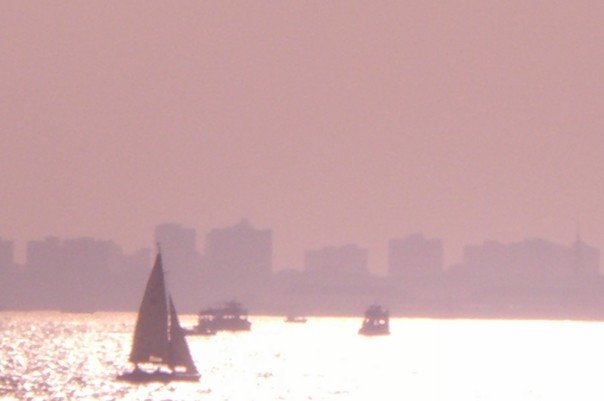
Here are some photos that I took whilst on a boat trip from the Gateway:


One thing that was clearly apparent was the fact that the harbor around the gateway was a very busy, working harbor. People were bringing goods in and taking goods out. This to me, highlights the importance of having the use of boats in a place like Mumbai as it is a great means of transporting goods and people using the water.

Quirky Ideas

The two images below are some images that I found on the net that someone has designed and made. I found these whilst looking at ideas related to water and society and decided that they deserved a post!

(p.s. Search word in google was moist!) I want these glasses!

Friday 27 November 2009

Ste's Weather updates

"The exterior of Stockport College is well and truly being gushed on" Steven Swanbaruga 14:34 27/11/09

Ste's Weather updates

" Matthew, it's looking rather moist outside! Stick that on the blog" Steven Swanbaruga 27/11/09